 Environment & Territory
The Environment and the Territory have always been our core business.
We orchestrate heterogeneous data and systems: sensors, cameras and real-time processing of satellite data, play a key role in land management.
Our solutions are based on open standards (OGC).
In this way our customers can manage their own data and processes. They have simple and user friendly interface.
We are experts in:
urban planning
environment
territory
roads mgmt
water mgmt
forest mgmt
cadastre
land taxes
civil defence

ESRI ArcGIS platform has four main products: discover them.
ArcGIS for Desktop
ArcGIS for Server
ArcGIS Online
Web e Mobile App
In the world of GIS, ESRI’s ArcGIS platform has always been the main product for the management of the territory and the environment.
Used by many local and central public administrations, can now be considered a “de facto standard“. From single user to WEB applications, ArcGIS provides a scalable system that is dimensioned depending on the customer’s needs.
Trilogis is EPN – Esri Partner Network
 Thanks to the great GIS experience, Trilogis belongs to the “Esri Partner Network (EPN)“. It is the exclusive international partner program of Esri Inc., in collaboration with National Ditributors (EsriItalia spa).
With Trilogis, ESRI Users always have a competent and reliable partner alongside.
All trademarked logos and logos belong to their owners.
do you need more info?

The cloud tool for integrated modeling of extreme alluvial events.
WEEZARD was born by the close cooperation between Trilogis and the DICAM research group of Trento University (prof. Rosatti)
WEEZARD is a cloud system that simulates, on your computer, the alluvial events typical of mountain regions.
You do not have to install anything: it is a powerful server-based SAAS (Software As A Service) system that uses UniTN computing algorithms and a versatile integrated webGIS 3D for displaying simulations.
do you need more info?
The WEB tool to manage
the certifications related to urban planning
GEO-CDU is a IT system to be used by public administration to manage the certifications related to urban planning.
The GEO-CDU product is addressed to public administrations and in particular to the Municipal Technical Offices.
Documents automatically produced by GEO-CDU serve professionals (architects, engineers, surveyors, etc.) and anyone who needs to know the urban destination of one or more cadastral particles.
You don’t need to install anything: it’s a web product.
do you need more info?
![]()
TRAINING
Public Administration, Companies, Professionals or Universities: Whatever is your GIS or WebGIS system, Trilogis organizes high-level training courses to suit your needs.
Our teachers have a proven experience and knowledge of the domain: they know what they are talking about.
Training can often come into the system’s start-up: this is how you learn by creating and using your own data (training on the job).
![]()
HELP DESK & ASSISTANCE
We work in partnership with you.
To stay daily at your side, we have an efficient Help Desk service ISO 9001 compliant.
Our service and maintenance customers can find answers to their small or big daily work problems.
We work with different levels of support: telephone, remote, on-site, etc.
Our infrastructure guarantees timely intervention times, speeds of remote connections and security/protection of the whole system.
![]()
SW DEVELOPMENT
Strong in the experience of countless tenders, projects, software developments, evolutionary maintenance, etc., our SW laboratories have accumulated a wealth of knowledge of wide development tools, deployed in many environments (desktop, client-server, web, mobile etc. .).
But not only.
Our experience allows us to offer software development services that cover the entire project cycle, requirements analysis and feasibility study, up to implementation and subsequent maintenance and support.

TAILORED SYSTEMS
Complex Territorial Information Systems are made “orchestrating” other systems and integrating their data.
For this reason we know how to design and realize “tailor-made” systems tailored to the needs of those who use them.
Thanks to our DNA of innovators, we overcome the concept of simple “system integration” and expand it with the necessary “data integration” and “integration of applications”.
BUILDING GEO DATA
The real asset of the Geographic Information System are geographic and descriptive data.
GIS Data must be accurate, reliable and up-to-date.
The quality of answer that a system can give depends on the accuracy of data in the database.
A wrong one will produce incorrect information and, as in a chain, all other related information (cfr. GICO – Garbage In = Garbage Out)
Even in this delicate sector, Trilogis has a tremendous experience and extensive domain expertise to help you to realize your best DataBase.
![]()
CONSULTING AND SUPPORT
As an example:
-
RFId technologies and other identification technologies (barcode, QR-Code, magnetic stripe, etc.);
-
GIS video location systems related to video surveillance indoor/outdoor;
-
Support for CAD (AutoCad/AutoCadMap) and GIS (ArcGIS) integration;
-
Consultancy in the areas of LBS systems (Location Base Services) and RTLS systems (ZigBee, WiFi, ultra wideband, optical, etc.) and implementation of integrated systems.
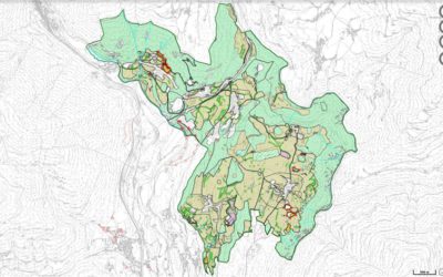
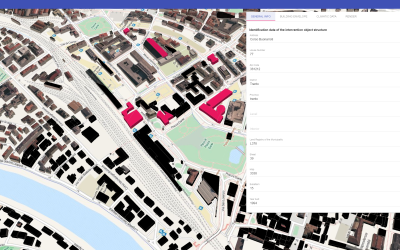
“NewPlan”: la nuova gestione informatizzata della Provincia Autonoma di Bolzano per tutti i piani urbanistici comunali ed il piano paesaggistico
NewPlan è il nuovo sistema informativo geografico della Provincia Autonoma di Bolzano per la gestione integrata dei piani territoriali. Nato essenzialmente per integrare e garantire quindi la coerenza tra piani urbanistici comunali e piani paesaggistici, può essere...
Trilogis sul Corriere della Sera (Corriere Imprese)
un bell'articolo di Linda Pisani del Corriere della Sera sulla nostra Trilogis. Grazie anche a Francesca Re , Davide Modena e Andrea Saggese di Trentino Sviluppo S.p.A. Clikka qui per scaricare il PDF [button...
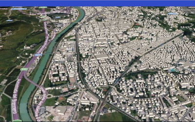
il progetto SeNECA ti dice quanto calore perde la tua casa o se il tuo tetto è adatto ad un impianto fotovoltaico
Da giugno 2017 il progetto SeNECA - Smart and sustaiNablE City from Above (finanziato dalla Fondazione CARITRO, rif. 2014.0508) è divenuto operativo. Realizzato in collaborazione tra Trilogis e FBK (Fondazione Bruno Kessler), SeNECA (http://seneca.fbk.eu) ha...
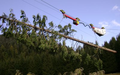
Dalla “Smart City” alla “Smart Forest”: in Trentino si pensa alle foreste intelligenti
il progetto SmartForest, sta riscuotendo un grande interesse su numerose testate di stampa online. ideato da Trilogis, Studio 3E di Trento e da JLBBooks di Trento, SmartForest si propone di rendere sempre più efficente e moderna la gestione, il monitoraggio e la...
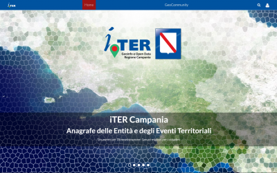
i.TER Regione Campania vince il “Premio Agenda Digitale 2016” del Politecnico di Milano
Il giorno 14 novembre 2016, a Roma, si è svolto il prestigioso convegno di presentazione della ricerca dell’Osservatorio Agenda Digitale dal titolo “Pubblico e privato: un patto per l’Italia digitale”. Nell'ambito di questo importante evento, La Regione Campania, con...
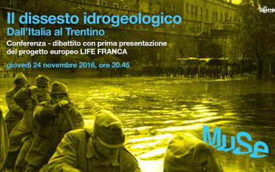
Il progetto europeo LIFE FRANCA: Come prepararsi alla prossima alluvione?
Giovedì 24 novembre 2016, a Trento, presso la Sala Conferenze del MUSE, si è tenuta la conferenza Il Dissesto Idrogeologico Gestire l'inevitabile, evitare l'ingestibile: dall'Italia al Trentino La conferenza ha centrato l'obiettivo di avviare una prima riflessione...
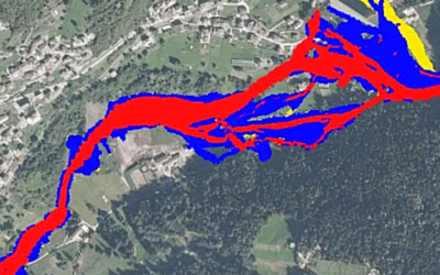
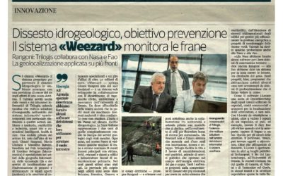
“il Dolomiti” parla di Weezard Il software di Trilogis e UniTN che prevede frane e valanghe!!
Weezard (www.weezard.eu) è un sistema webGIS progettato per prevenire il dissesto idrogeologico in ambiente montano; riesce a prevedere con un errore del 5% gli effetti di una colata detritica. E' un sistema web progettato e sviluppato in stretta collaborazione...
il Progetto SeNECA sulla rivista GeoMedia.it
SENECA - Smart and sustaiNablE City from Above: Modellazione 3D a scala urbana per l’efficientamento energetico di edifici. SeNECA è un progetto cofinanziato dalla Fondazione Cassa di Risparmio di Trento e Rovereto – CARITRO. Il monitoraggio territoriale, la...
Cittadini consapevoli dei rischi idrogeologici sul loro territorio: è l’obiettivo del progetto Life FRANCA
Sostenere la consapevolezza dei cittadini del rischio di alluvione e la sua prevenzione. Questo è l'obiettivo di FRANCA (Flood Risk ANticipation and Communication in the Alps), progetto europeo LIFE (http://ec.europa.eu/environment/life/index.htm). Lunedì 19...
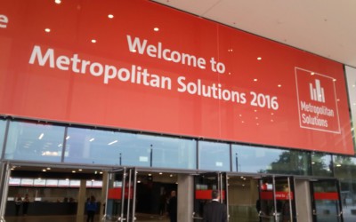
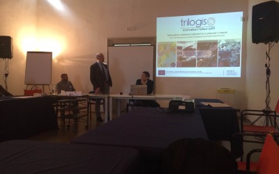
Metropolitan Solutions di Berlino: Trilogis presenta le tecnologie geospaziali per l’innovazione nella pianificazione urbana e territoriale.
Dal 31 maggio al 2 giugno 2016 si è svolta a Berlino l'esposizione internazionale Metropolitan Solutions un mix di conferenze internazionali, di spazi espositivi e con una piattaforma di matchmaking. il tema chiave è stato lo sviluppo urbano sostenibile, con...