An app to help FAO

The goal of this application is to help FAO   providing support to national locust operators in Africa and Middle East.

Desert locusts are a huge problem for the population and due to their ability to change their behaviours and habits.

These locusts are hard to limit as they form swarms and move rapidly (about 20km/h). Moreover, they can consume (in 1km² swarm) as much food as 35.000 people eats in a single day.

Nicola Dorigatti, Nicola Meneghinii

Source codes

The source code of the Android WorldWind SDK can be found at:

https://github.com/TrilogisIT/WorldWind_Android/tree/fao-master

While the Android Application and the Desktop Application:

https://github.com/TrilogisIT/FAO_Application

DOwnload the App
Android Application: http://goo.gl/QeXwCz
Android Zip Data: http://goo.gl/lvwYdY
Desktop Application: http://goo.gl/bltUYL
The Android application can't work alone because it has developed to work offline.
You need the zip file called "wwtiles.zip" that must be copied (not extraced) in the root of your device SDCard, either if it is emulated by the phone or a physical SDCard (External memory).

After copying data, just open application and follow the instruction (the app will automatically get the cache from zip file and startup the environment).

The application requires an OpenGL ES 2.0 capable device and has been tested on tablets even if it can work also on phones.

The Desktop Application is based on WorldWind Java SDK (already included as a jar) and on GDAL libraries.
There is a small issue in GDAL loading so, if you open the application and browse for files, it can show no options. 
This is due to GDAL not already loaded when opening the window, so close the dialog and open it again, it will work.

Sample input data is not provided due to copyright restrictions, but you can try with your own GeoTIFF and DEM files.

Greeness and Rainfall layers are available to public:
    http://iridl.ldeo.columbia.edu/maproom/Food_Security/Locusts/Regional/greenness.html
    http://iridl.ldeo.columbia.edu/maproom/Food_Security/Locusts/Regional/Rainfall/index.html

They can be downloaded as GeoTIFF from the web interface.
    
The bounding box is for limiting output size and data, and has to be expressed in Latitude/Longitude (decimal degrees).


Visit http://www.trilogis.it/


For this specific project, both the Desktop and Android WorldWind SDK have been used as starting point; the desktop code has been improved in order to allow the creation on the fly of mobile friendly map data (compressed tiles), while the android SDK has heavily changed in order to allow a lot of more functionalities and bug fixes. 

Video


Features

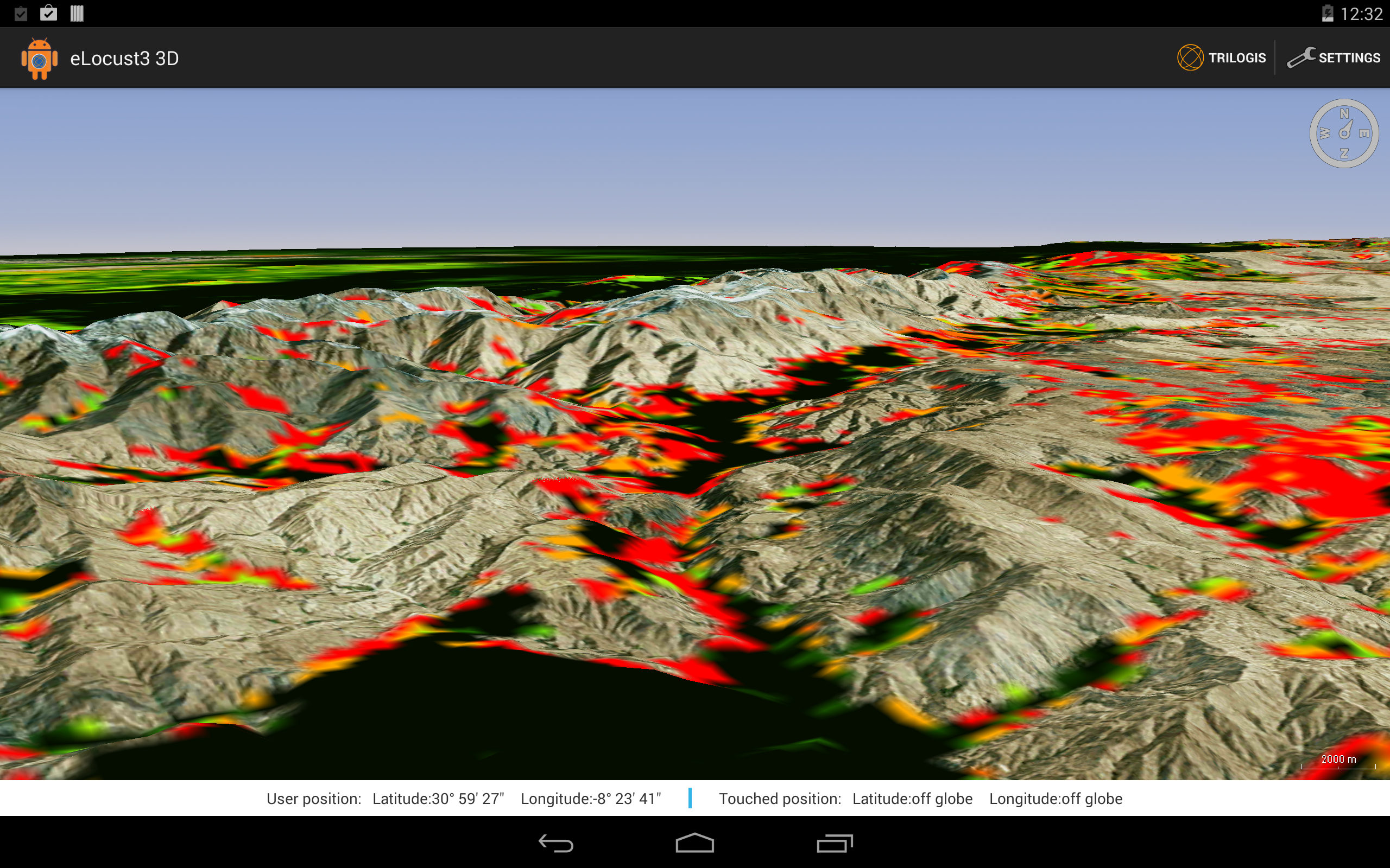
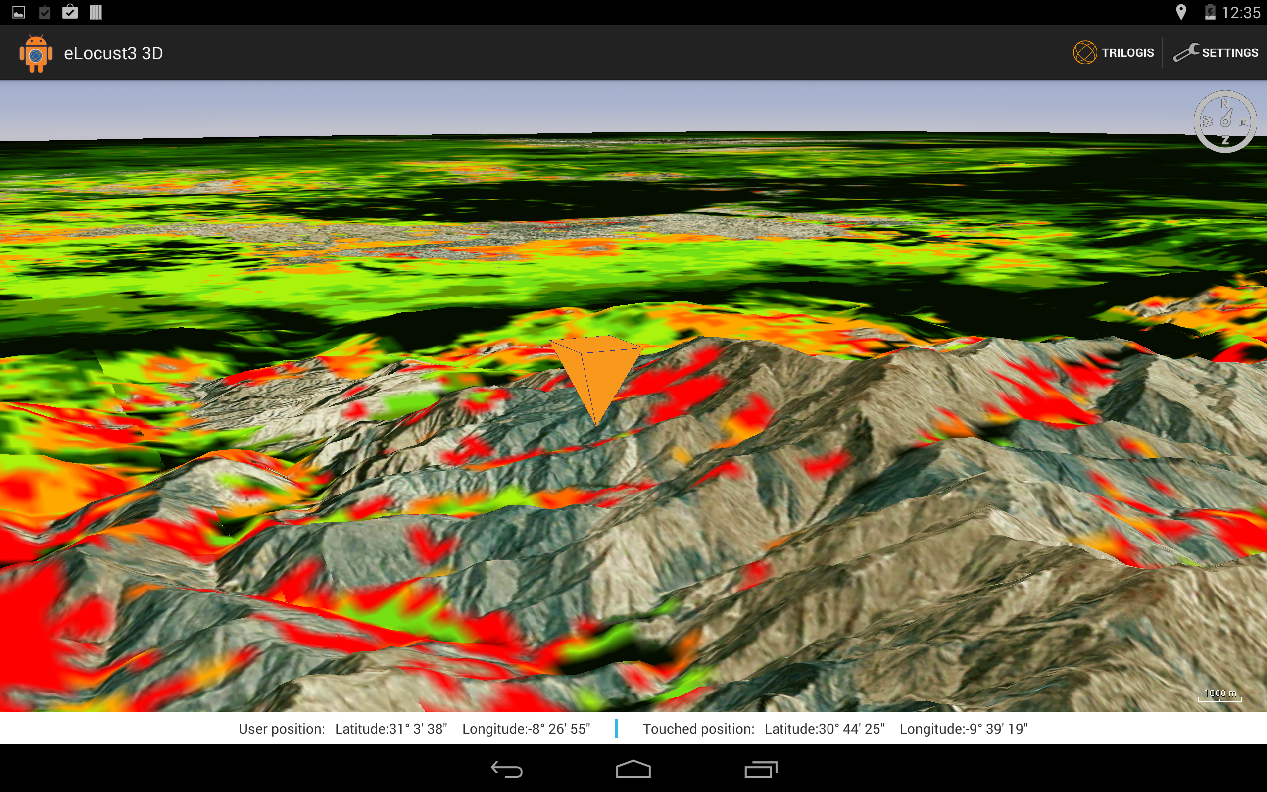
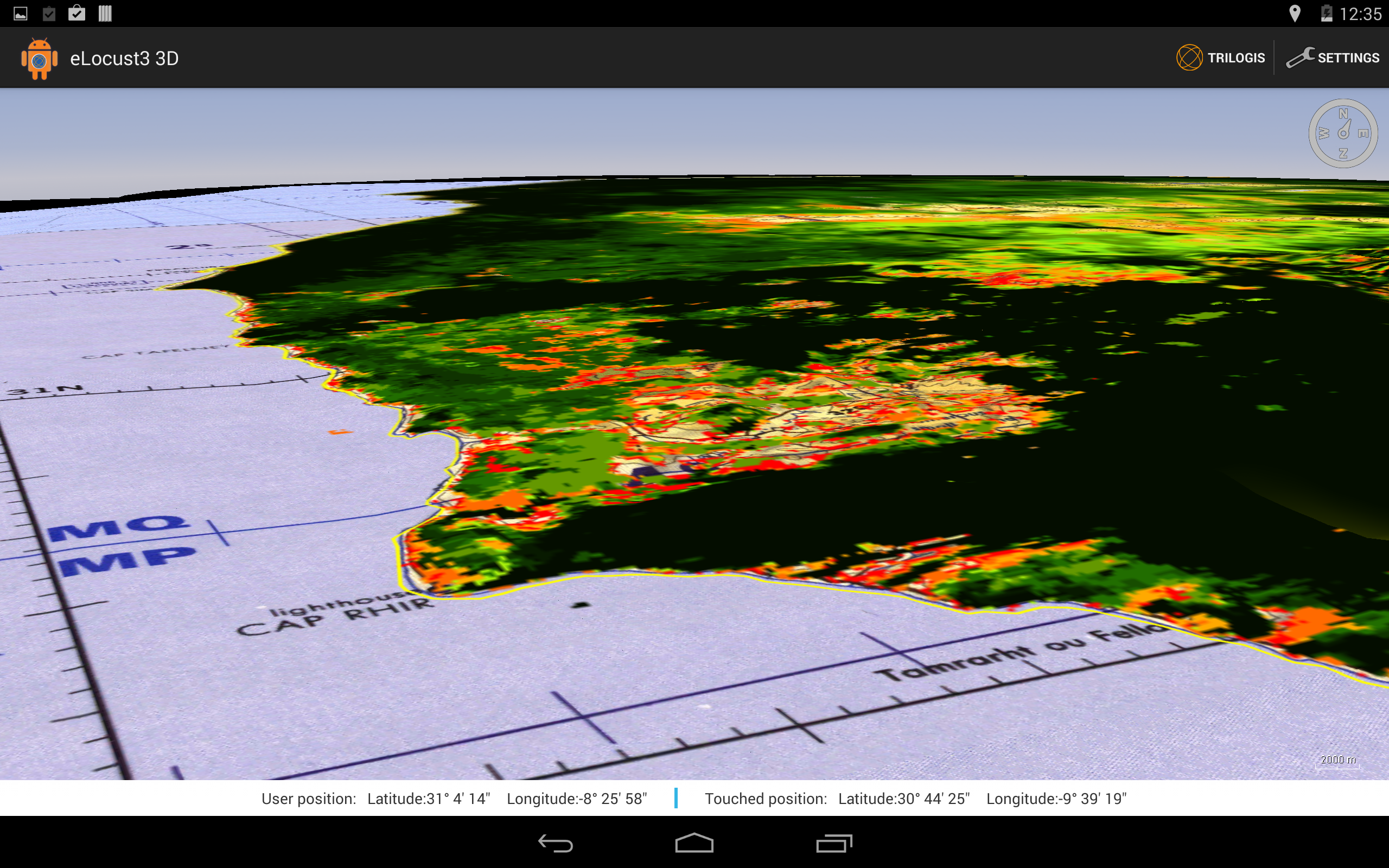
The Android application helps operators while on the field, allowing them to work on a 3d mapping environment without the need of any connection. Map data is already saved into the device before going in situ, allowing users to work easily and with no costs.

The desktop application creates textures either compressed or uncompressed to be used within the mobile application together with the configuration files for the WorldWind layers.

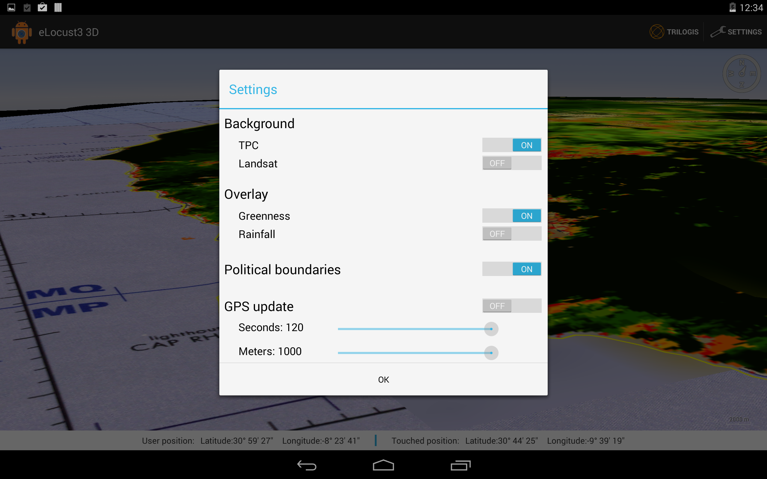
It is possible to control in real time the operators’ position and automatically zooms there, so they can monitor and check the situation around without driving for kilometres. They can change layers visibility, switch from a background layer to another and  there are many other features. 


Screenshots